
The San Juan Solstice is a true Colorado gem. It is located in the remote town of Lake City about 5 hours SW of Denver in the San Juan mountains. This would be our first time running this way overdue event. SW Colorado is my favorite part of the state and this the same general area as Hardrock 100.
The course is a counter-clockwise loop with over 12,000+ ft of elevation gain with altitudes ranging from 8,671 to 13,334. It has three major climbs and includes about 11 miles of above tree-line running.

We made this a quick weekend adventure leaving Denver on Friday which is plenty of time to get to Lake City and get checked into the race and our hotel (Inn on the Lake - a great place). After checking in we had to wait and extra hour for the director to finish his helicopter tour of the course and the fire in nearby South Fork. We could all see the smoke plum rising from the East.
In the briefing we learned that there was no threat of the fire moving west and there would be no smoke. We then finished our spaghetti dinner and went back to our hotel.
The next morning we woke up at 3:15am and got all of our gear together and met an Utah runner outside needing a ride to the starting area. As a coffee drinker, both of the town coffee were open to give us our morning boost and breakfast.

The race began at 5:00am in the dark. Most runners did not bring headlamps yet I may bring mine next time for the added visibility. The first three miles was fast moving up the dirt Engineer road to the Alpine Gulch trail-head.


(Looking back down the canyon and the steam of running coming up)

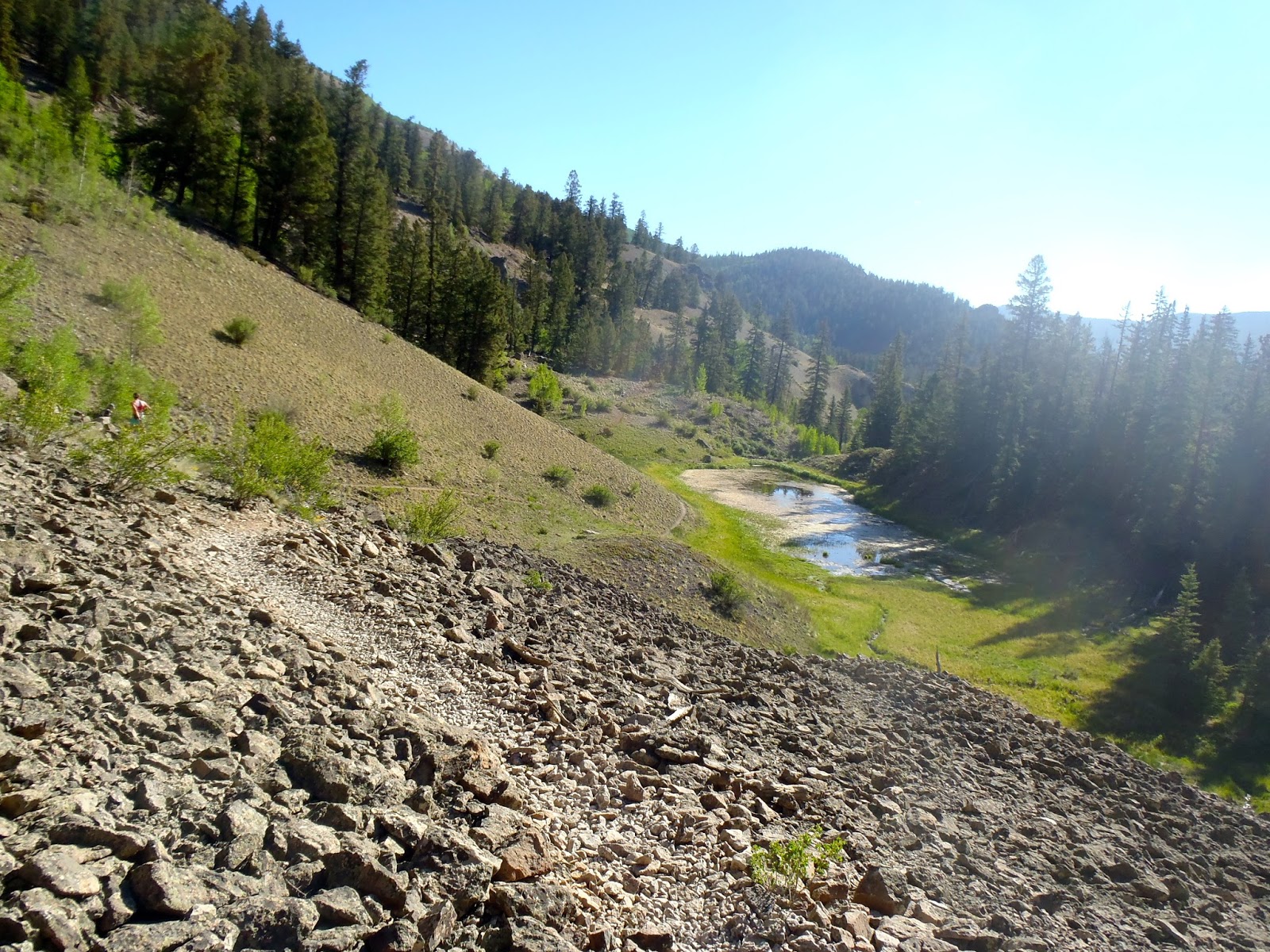
Just past the 1st aid-station on switchbacks to the ridge


Below, I stepped up off the course to take this great pick of Alpine Gulch where we just climbed 8,000ft from below. The town of Lake City is off to the right.


It was nice to saddle the ridge yet there was more climbing to this point above and then another mile along this ridge until it finally began to descend to the valley below. Also in the picture below, that is the next mountain range I would need to climb and run on.

(below is a false descent)


(After the traverse in the pic below the race would begin the descent)

(below is a steep downhill road)


Along the way I took a good face-plant and scraped up my knee. Since it was in dirt, I did not have to rub any additional dirt on it!

At mile 15.7 was the Miller Creek aid-station. This was the only place where I had a drop-bag and all I used was the Gu. I reloaded my bladder and ate some solid food before leaving. A few important considerations about this aid-station. 1. It is the only spot for a real restroom 2. If it is a snow year a drop-bag would be a good idea with all the water and possible snow crossings. 3. Most important the tight 10:15am cutoff (that got Kelly)

The next few miles was along a good gravel road to the Wagner Gulch turnoff. It is a gradual climb and very important section to make time. I made it a point to run the entire section until Wagner turn.
The Wagner Gulch trail is actually a steep jeep road that goes on forever. It is actually 3.6 miles to the aid-station then another 3 miles to the top of Coney Peak. This section climbs 7 miles from 9,316ft to 13,336ft.


I made good use of my trekking poles and powered my way up this section passing many racers. I made sure I kept well hydrated because the heat was in full force and I also kept up with my Gu intake.


(looking back at Carson)

(Top of the Divide looking to the South)


Still continuing the climb, the course joined the Colorado trail. It was hot and the air was thin yet it was nice to have zero signs of thunderstorms.

Finally, after reaching the top of the climb, I was able to enjoy some great view of where I came up from and many San Juan 14ers in the distance.


One of the underlying concerns during the race was the potential hazards of the West Complex fire near South Fork. In the picture below, it show just how close it was to us yet the wind kept it moving to the East.
After reaching the top, the race bobbed up-and-down along the ridge. I ran most of it yet I wish now that I pushed my self harder in this section.


(one of the few snow crossings)

Below is the race director for the Orca Island 50K, I had a good time talking to her about all her adventures. Also it is easy to see the trail snaking along the ridge below and a few of San Cristobal Lake (the 2nd largest natural lake in Colorado).


(View back showing the descent)


At mile 31, I reached the remote Divide aid-station. This time I need more time to prevent some potential blisters on my feet. I was carrying my Hydropel and fresh socks. I believe the dust was starting wear on my feet so this was a smart move for later. I also enjoyed some noodles and more sandwiches.
My general strategy for fueling 50+ mile races is to eat solid food in the aid stations and Gu Roctane on the trail with the occasional SportLeg. I will do the Gu every hour unless I get the solid food and this has worked well in controlling stomach issues.
After the aid-station, I had two more mini-climbs (the next tow pics show the one out of the aid-station) for the next 10 miles.


Pictured above was the last mini climb of this section. When I reached the top, I determined I had plenty of fuel in my tank and so I made the decision to really push myself to the finish. So after I had a fast 4 mile descent where I ran faster then I usually would due to the steepness. I used my poles for stabilization and ended up passing many racers on the way down.


I kept hearing about the dreaded last climb from other runners but I was not going to allow it to deter me. It is 1,600ft in about 2 miles yet the trees made it really nice. Occasionally, a gust of wind would cool me off as I powered my way up and again I was able to pass about 6 racers in this section.

(Race maker by one of skulls on the course - funny)


(nearing the top)


Just past the top, I refilled my bladder one last time at the 46.5 mile Vickers aid-station. There I also enjoyed a quick cup of ice water. The heat was major factor in the race and I fought it by drinking the hydration mix twice a mile.

Just past the aid, there was steep rocky descent towards town. I did make the choice to continue to run but at safer pace and no sense in twisting an ankle. Below is the switchback section leading into town that eventually hit a smooth dirt road on the backside of Lake City and then into town.


Finally after 13:41:08 of racing I crossed the finish line in 108th place. In the end, I had a great time and feel I ran a smart race and will be better condition for the rest of the season. Kelly, has already committed to take revenge on this course and I hope to best my time too.
This is a very remote location yet it is 100% worth the trip. The town, the people, and the race organization are wonderful.

No comments:
Post a Comment